DHA Phase 2 Islamabad Map
Explore DHA Phase 2 Islamabad on Google Maps. Find all 9 sectors, entry gates, and get directions.
Map Preview
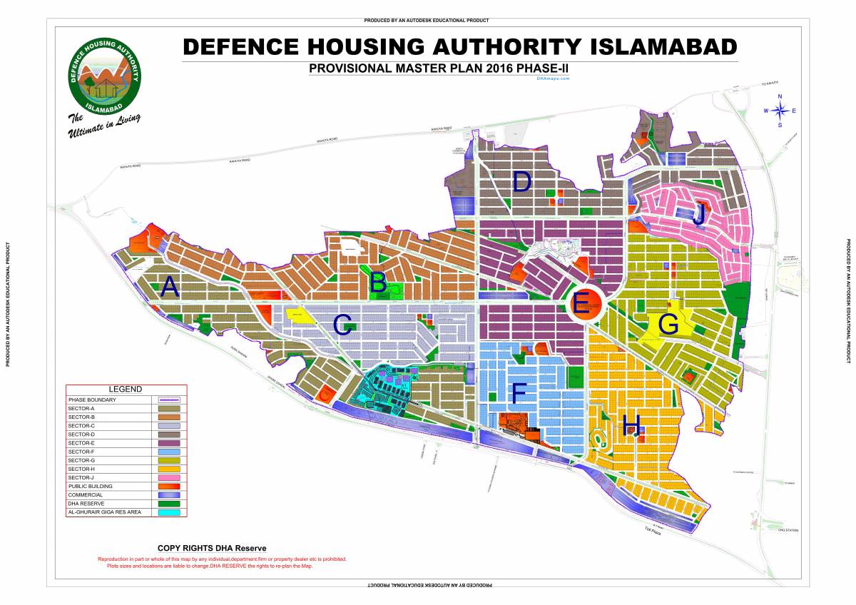
DHA Phase 2 Master Plan
Preview the master plan layout showing all 9 sectors, main roads, entry gates, and key landmarks.
Downloads
Download Map PDFs
Download the complete master plan or an individual sector map for offline viewing and reference.
Master Plan PDF
Complete DHA Phase 2 layout with all sectors, main roads, entry gates, and community landmarks.
PDF · 3.87 MB
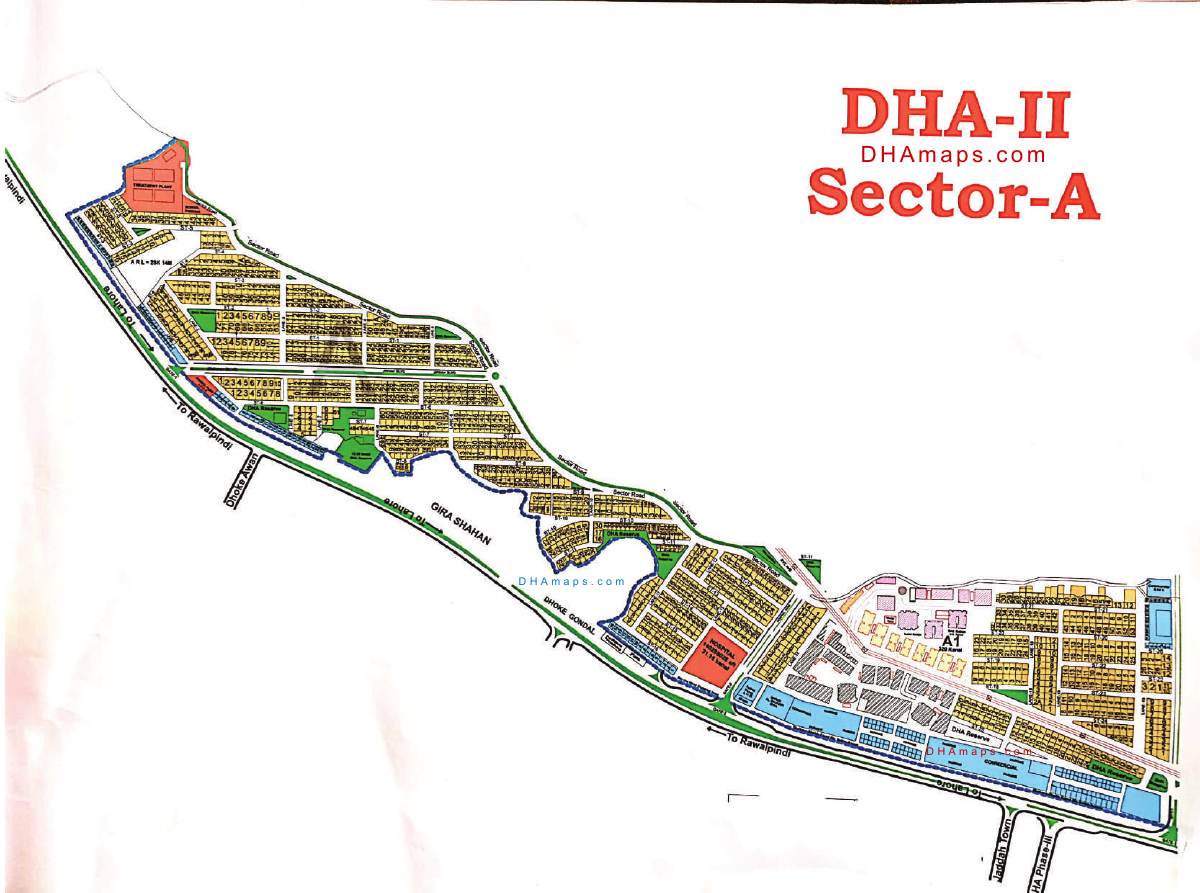
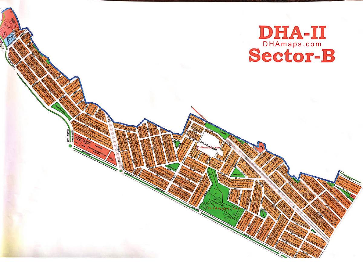
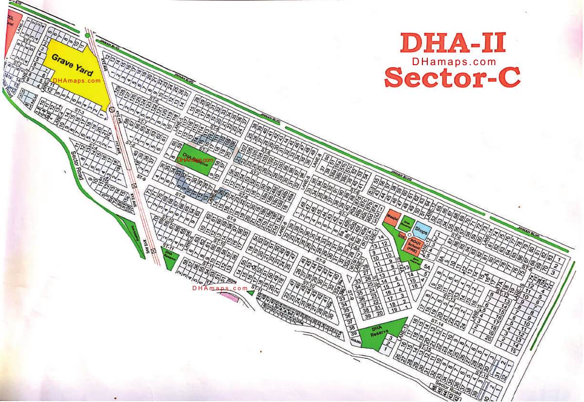
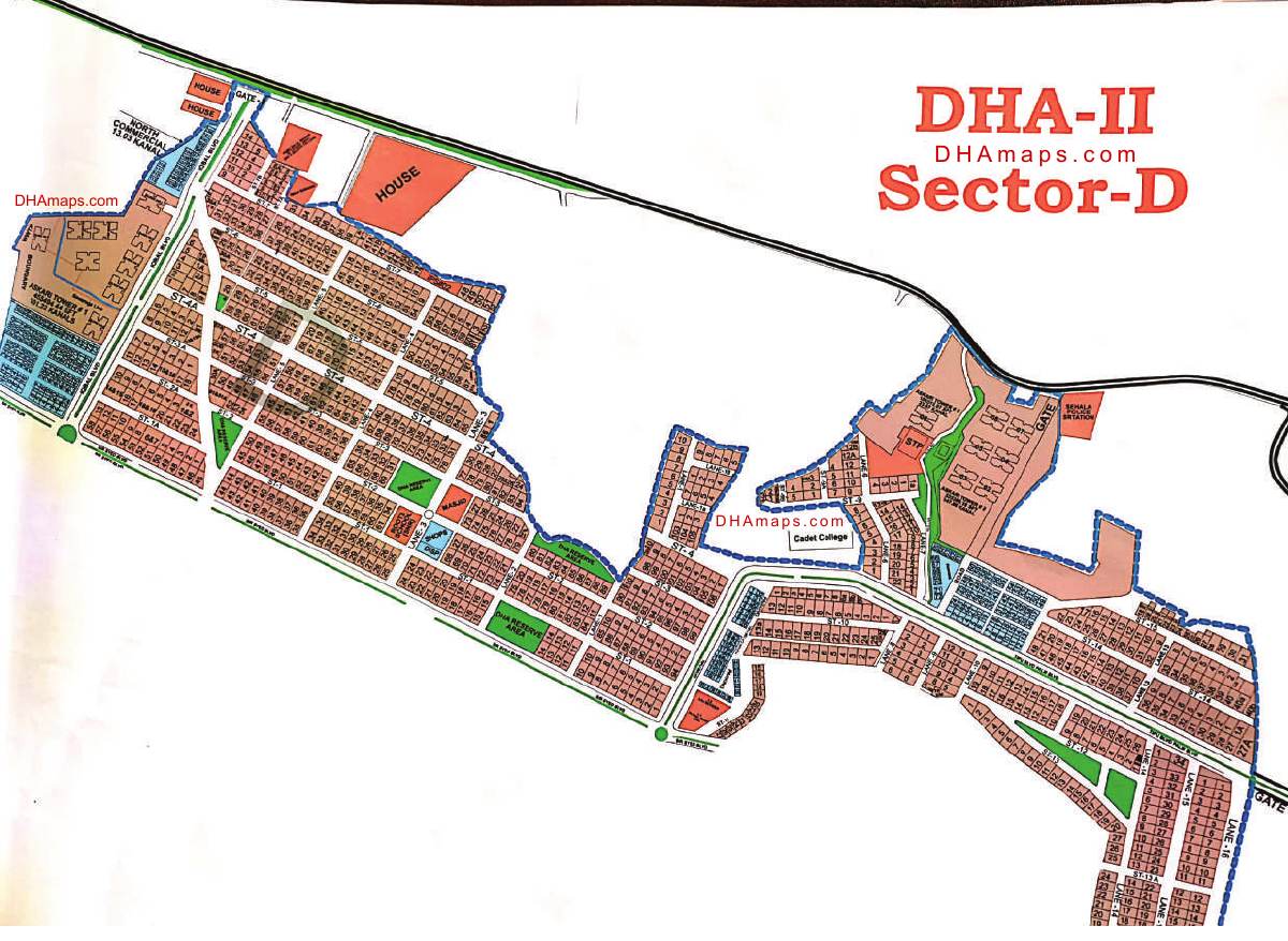
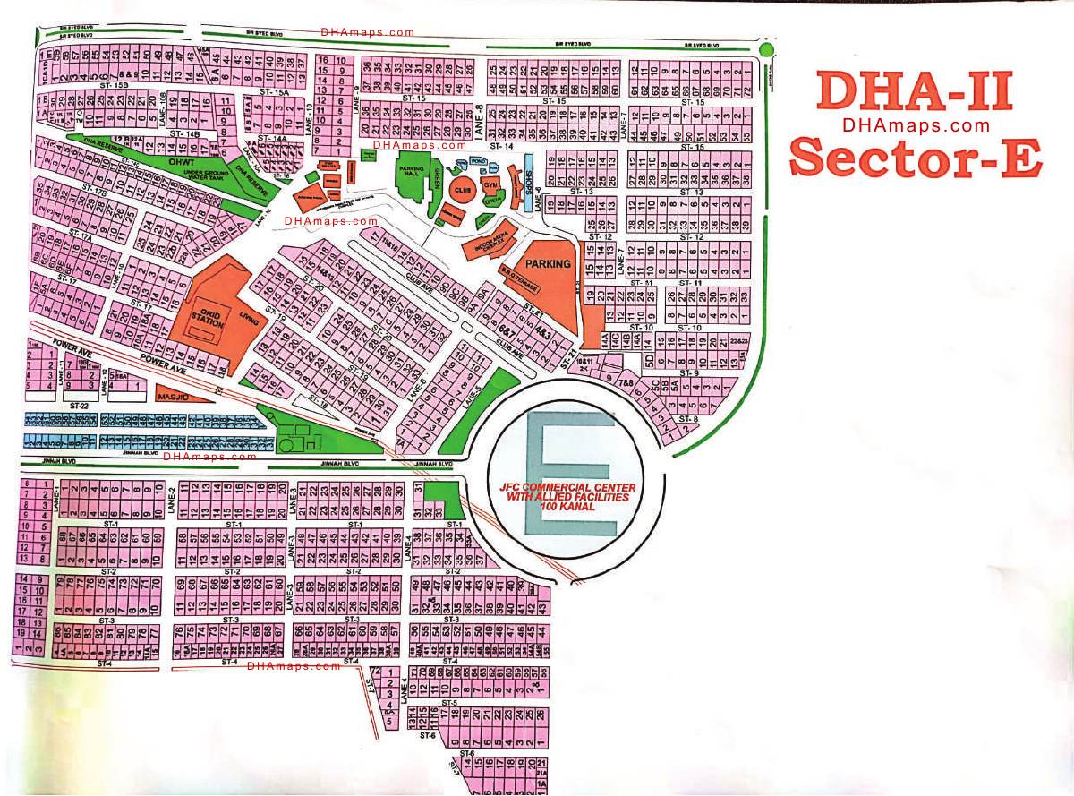
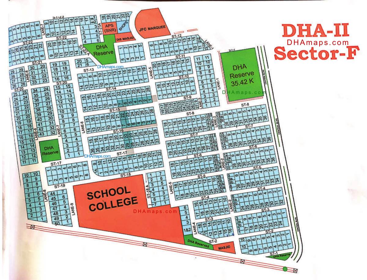
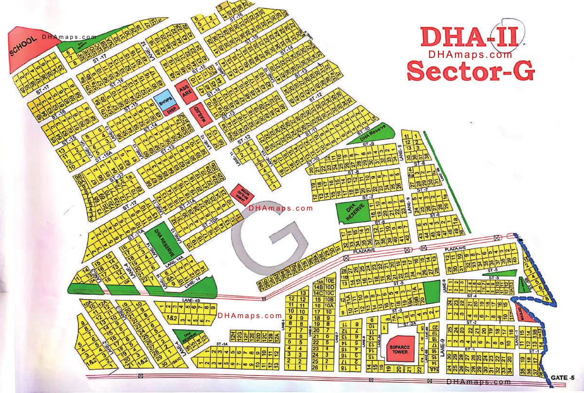
Map Guide
How to Read the DHA Map
Understand the key elements and symbols used in DHA Phase 2 maps.
Plot Numbers
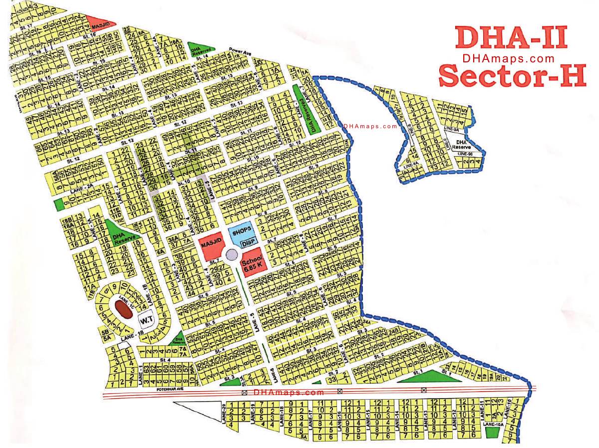
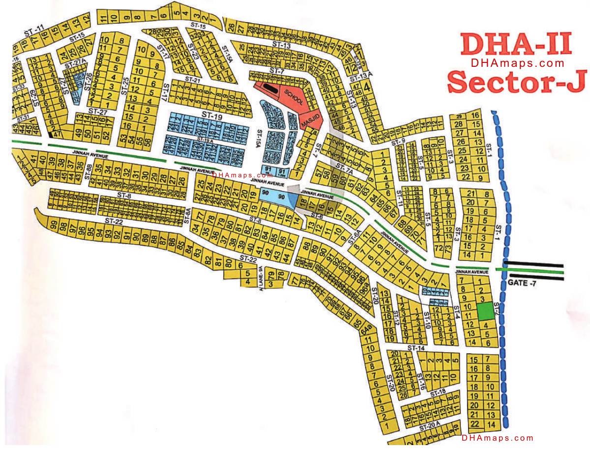
Each plot is identified by a unique number within its sector. Numbers are shown inside the plot boundary.
Roads & Streets
Main boulevards are shown as wider lines. Sector roads appear as medium lines, and internal streets as thinner lines.
Parks & Green Areas
Green shaded areas indicate parks, playgrounds, and landscaped open spaces within each sector.
Community Buildings
Mosques, schools, community centers, and commercial buildings are marked with distinct symbols and labels.
Entry/Exit Gates
Gate symbols along the boundary indicate the 10 entry/exit points of DHA Phase 2 with their gate numbers.
Sector Boundaries
Dashed lines indicate sector boundaries. Each sector is labeled with its letter designation (A through J).
External Links
Related Resources
Official and third-party resources for DHA Phase 2 Islamabad maps and information.